Colorado Rockies
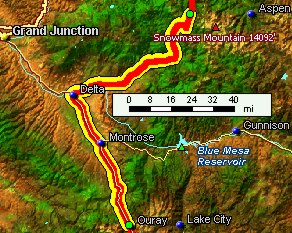
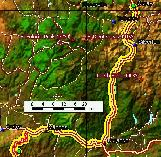
Down the mesa, breakfast in Durango, which has turned itself into a lovely town, and then over the Million Dollar Highway through Silverton to Ouray, a sparkly village in the heart of the southern Rockies. Even in the high mountains, it's horribly dry. |
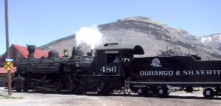
Durango-Silverton steam train |
We got to Silverton, a chilly village high in the Rockies, just as the tourist train, a wonderful old pufferbelly, chuffed into town. |
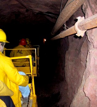
We took our own train ride, into a mine addit near Ouray. The little electric train rattled us 3,500 feet into the heart of the mountain where Miner Steve told us about hardrock mining. The whole of the Colorado Rockies is riddled with shafts and pits, memorializing a time when our countrymen lived to rape virgin land for profit.
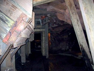
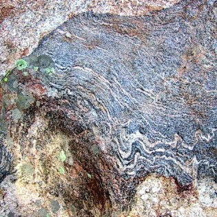
mine "gallery" or working face
The object of desire was the gnarly dark broken looking stuff in the upper right -- the "vein" which in some cases was fifteen feet thick and produced some of the richest ore ever discovered on this continent.
To me, the two most amazing things about this whole enterprise were the toughness of the environment, and the undoubted heroism (or at least stoicism) of the miners, and the thoughtless poisoning of the precious waters in perpetuity. Anything for quick and easy wealth, right? |
mine train deep in the addit
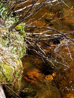
The Bachelor Syracuse mine pulled millions of dollars of silver, lead, and gold out of the roots of the mountain, and threw the tailings over the edge. In this part of the Rockies, despite Superfund clean-up efforts, the streams run green and toxic, and it's hard to tell what's Nature and what's tailings.
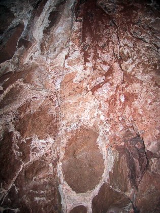
rich ore vein and matrix |
Ouray
Next day, we drove back down onto the margin of high desert that borders the Rockies on the west, then back into the Rockies into the Crystal River valley, a tributary of the Roaring Fork.
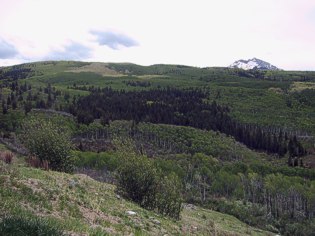
Aspen masses in the high country |
I'd always driven through Ouray and thought, "What a nice town, and what a spectacular location! I'd like to stay here sometime..." So we did. Turns out it is a lovely little town, isolated and completely dependent, now that the mining's over, on tourism, Main Street completely taken over by cute gift shoppes. Ouray's one enduring claim to fame is its hot mineral springs; even our motel had one.
After New Mexico's ersatz adobe -- they call themselves a "third world state" -- Colorado's trim brick buildings and broad, well planned streets were a surprise.
Aspen, one of the predominant trees above 8,000', may start as individual trees, we learned, but their roots connect, and large populations of them, sometimes hundreds of trees, coordinate their spring leaf and autumnal color behaviors. The consequence is that in Spring and fall, groups in different states provide a striking patchwork on the mountainsides. |
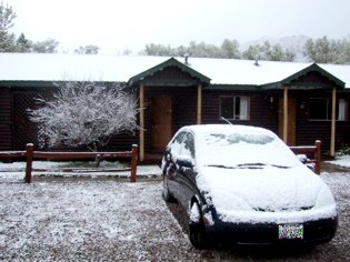
Our first morning in Redstone, we were greeted with snow, not enough to change our plans, but enough to refresh the whiteness on the slopes and give a hint of what winter here might look like. Here's our little Prius parked in front of our room. By the time we were ready to go, the snow was gone. |
|
poster at RMI |
We took the tour at Rocky Mountain Institute, where we learned that the rat snake has been replaced by a more personable rodent control critter, a weasel. Nanuq the 1,000 watt dog and the iguana are no longer with us, but RMI thrives. The waterfall is still in good tune. Our hybrid Prius had a nice conversation with Amory's new Insight.
The poster reads, "Leaders are best when people scarcely know they exist, Not so good when people obey and acclaim them, Worst When people despise them. |
"Fail to honor people, they fail to honor you. But of good leaders who talk little, When their work is done, task fulfilled, People will say, We have done this Ourselves!"
The RMI building is about 20 years old now, and works as well as ever. Well-insulated double slipform native rock walls, super windows, carefully thought-out ventilation and balanced passive solar heating, have more than proven their worth here, which raises the question, since it works so well, why don't more people build this way? |
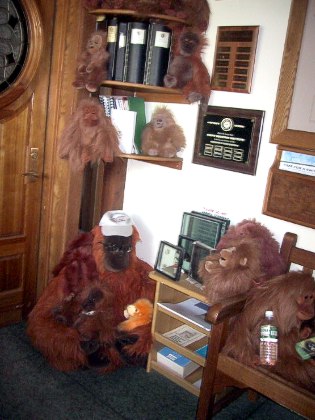
Amory's stuffed orangutan collection |
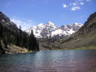
Maroon Bells |
The next day, we drove up to the end of the road along Maroon Creek to view one of the most-photographed, most iconic of all mountain scenes. I have seen this picture on the wall of a restaurant on Crete (among other places). What is it about these rugged peaks that represents the purity and majesty of alpine scenery? |
This is the crown jewel of the Forest Service, just up the road from Aspen, and they've done a good job of preserving it from logging and the masses of tourists that come to it. There's plenty of wildlife -- we saw deer, marmot, and the happy and well-maintained homes of beaver. It's also clearly fragile land, where any kind of disturbance -- mostly avalanches -- leave scars that take decades to heal. |
beaver pond on Maroon Creek |
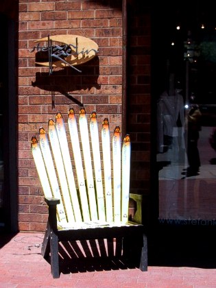
recycled skis
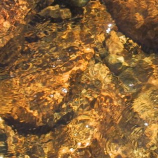
We drove up Independence Pass to the 11,000 foot level to get a feel for the alpine, and stopped beside a crisp little mountain stream. Even here, it's terribly dry.
We sat on a rock and watched climbers scale a sharp cliff. The air here has the crystalline quality of the water.
|
Aspen was the first stop on our tour of glitzy ski "villages" -- it's too big and well established to be called a village, but the town has a lived-in quality. Lots of greasy fast food, but finding something authentic to eat took us out of the center of town. There's an uneasy feel here, a little like a hang-over, undoubtedly due in part to the slow season between winter and summer, but possibly also due to the prevailing mood of repuglycanism that has swept the land: perhaps Aspen is uneasy in its role of the ski resort of the loyal opposition.
free climber (red circle) |
Aspen grove, Independence Pass | Again we noticed the patches of Aspen, some in full new leaf, some tentatively leafing out in a yellow green almost white in the sun, and some patches at the same altitude holding out for warmer times or more water. Everywhere we heard complaints about the three year drought, and the mournful refrain, "we'll be okay after a couple of normal winters..."
The day we left Colorado, every county in the state was declared a "drought disaster area" -- this enables low-cost loans for upgrading systems. We heard very little about conservation. But wait! You can only water your lawn every third day! Now THAT'S a really big deal in Colorado. |
Vail icon
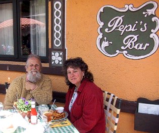
Not too far below Vail, we felt hungry, and decided we needed to check out the glitzy ski village favored by the ruling party. I found the statue of the ski trooper to be somewhat ominous, and Vail feels very plastic and transient (if well organized.) For what it's worth, we found excellent food very easily. Our extremely competent waitress offered to snap our picture when she delivered the food, and even contrived to get the restaurant's name in the picture. |
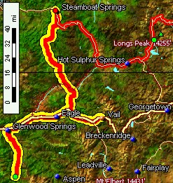
The next day, we headed on up the Rockies, through the magnificent Glenwood Canyon, toward Steamboat Springs and our friends the Whitacres.
|
Our route took us across the Colorado River again, and through some desolate, strange western slope territory that felt like alpine desert. After winding about, we arrived in the large, green park at the headwaters of the Yampa River, where Steamboat Springs holds forth as "Ski Town, USA."
We stayed with our friends, Mike and Janice Whitacre, and thoroughly enjoyed their hilltop home surrounded by Aspen. Steamboat is an unselfconscious town (compared to Aspen and Vail), an altogether easier environment to live in, I imagine. We got sodas at the old fashioned fountain and sat on rocks to watch the kayakers play in the Yampa.
|
Onward over Rabbit Ear Pass to Grand Lake, at the southwestern entrance to Rocky Mountain National Park.
|
The town of Grand Lake, situated on the shore of a lovely but sinister lake -- the Utes didn't like to stay around here -- gave us a good dinner, but it also gave us the willies. When we drove through Estes Park on the other side of the mountain, we were nevertheless glad we had chosen the less-spoiled town to stay in. |
Grand Lake morning |
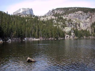
The high point (elevation 12,090') of Rocky Mountain National Park is Trail Ridge Road, which winds over an unbelievably high, round-topped ridge. Even on a calm day, a bitter wind whines, making extra-vehicular activity trying. The views are spectacular, and the trip is worthwhile. |
updated 2 June 2002 : 11:33 Caspar (Pacific) time this site generated with 100% recycled electrons! send website feedback to the Solarnet webster | |
© 2001-2002 by Caspar Institute. All Rights Reserved. |