| itinerary < 10 October River Day 6 12 October River Day 8 > | River Day 7 11 October 2014 |
|
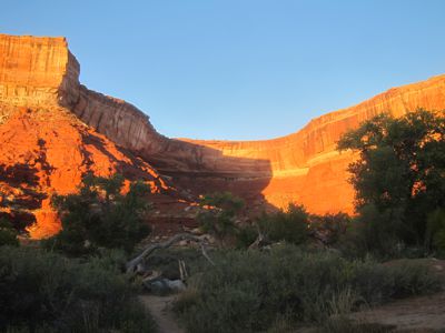
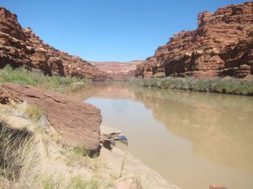
One of the best parts of an extended trip like this, for me, is the way the travel and the countryside rearrange the daily regimen. Always up before sunrise, always outdoors after sunset, I have a better chance to appreciate and celebrate those dawnings and settings. Here, on a day when I began thinking the trip might be too short, we got another gorgeous sunrise. We packed up camp in record time, but without hurrying, took care packing our canoes, and headed out around Turks Head and beyond, with a goal set, a camp Sienna had stayed in on an earlier trip, that had stolen a water bottle from her: Black Hole. (Be careful what you name things.) |
 |
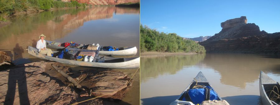 Ready to Cast Off, Turk’s Head |
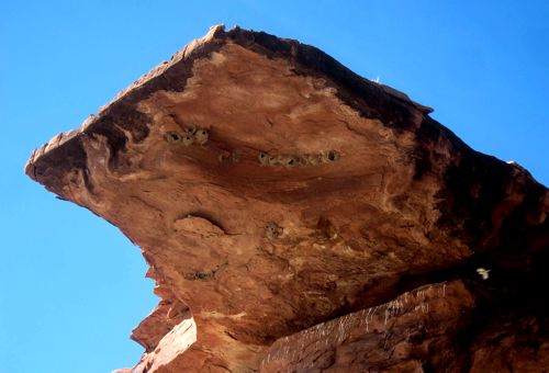 |
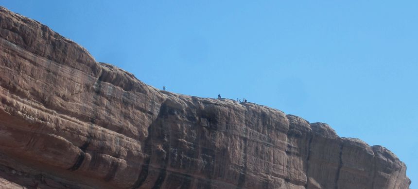
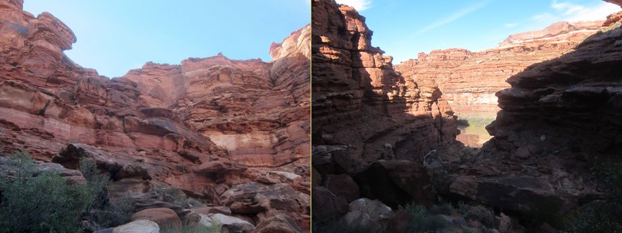
Traveling at the river's speed, two or three miles an hour, messes with time, but it enables close examination of every rock and bush ... even in a land absolutely chock full of rocks and bushes. Life clings valiantly to every possible surface – here, cliff swallows have made their nests for centuries on this jutting piece of overburden. When the day's itinerary calls for a relocation only a few miles away, the changes are subtle. River east is shady in the morning and catches the last rays of the sun. River west is the opposite. On this day, we only saw people high above us, again, on the White Rim Bike Trail. |
 |
|
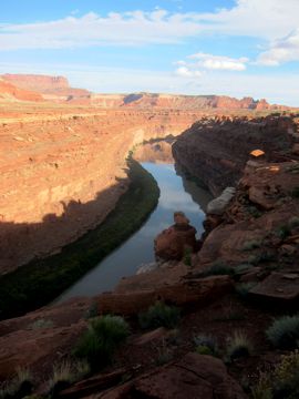
We arrived at Black Hole (you get to name your campsites) just after lunch. This wasn't an ideal location for camping -- the kitchen was awkward and the high canyon walls meant late sun in the morning and early dark in the evening. But this site has one of the most prized qualities in a campsite in the canyon: access to "the top." Of course there are many levels of the top; here, it was a broad white-rock plain about 400 feet above the river, up a rocky wash that showed abundant signs of a recent deluge. As the steep slopes and abundant rockfalls suggest, at least some of the cliff face is soft sandstone, easily eroded and somewhat technical to climb. But both of us are scramblers born and bred, and we gained the top well before the light began to fail. |
 |
 Half way up, the view up and down |
 |
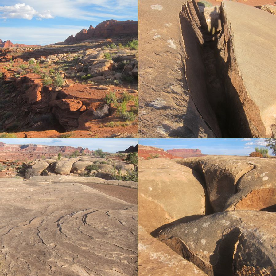
Of course, as soon as one gains the top, one looks down river. Here we saw a straight and easy reach, an island to avoid – islands usually mean sandbars – and then a sharp bend. Easy paddling, unless there's wind. The wind here is usually up-canyon, and the sky was telling us that there was weather in store. But for now, look around! More petrified sand dunes (the usual author of the white band) whose underlying strata had eroded away, fracturing many of the dunes along their interstices. The scale is very large, barely narrow enough to jump over. Once again, evidence that the depressions in the rock tops had lately been full of rain-water. Rain doesn't fall gently here; it falls in buckets, turning every little swale into a rushing stream, and pouring over the cliff edges in sheets. Or so I am told. In my heart, I was blessing the clement weather that had favored us: not too hot, very little wind, just enough cloud to make pretty pictures. Please, oh please, weather gods, keep it coming! |
 |
 |
updated 16 June 2023 Caspar Time site software and photographs by the Caspar Institute except as noted this site generated with 100% recycled electrons! send website feedback to the CI webster © copyright 2002-2024 Caspar Institute |