| itinerary < 12 September Point Roberts 14 September Mazama > | to Mazama 13 September 2019 |
|
In and out of Canada this morning. We had $40 CDN that we wanted to spend, and thought we'd be buying gas if we didn't find a bakery – ever notice how whatever it is you need to find isn't there until you settle for something that's not quite right, and then, having filled the need, you see nothing but whatever it was you were previously seeking. So it was with the bakery this morning. As the signs began to warn of the looming border crossing ("Border Delay 20 minutes" – another Trumpian lie!) we decided to get off the highway and get Canadian gas with our remaining Canadian money – they pay something like $6 US a gallon, due to higher costs plus big tax, and so we had tried to avoid buying any (and we succeeded). Just as we got off the highway I saw a big barn with a HONEY FOR SALE sign ...so we got BC Honey instead. |
 |
|
The border crossing at Peace Arch / Blaine is a nightmare. (I can only imagine how bad it must be at a busy border crossing from Mexico!) It took fifty-six minutes; the average immigration clearance, I calculated, was three-plus minutes from the time you were greeted by the troll in his troll both until he let you drive on. Took us 30 seconds once we got there. The only thing I can figure is that the predominantly Canadian traffic – what are they going to the US for? Cigarettes? Gas? Not drugs, for sure – weren't well documented and so getting them clearance took much, much longer. But the whole Customs and Border Patrol (CBP) bullshit is so short sighted and racist! Compounded by the fact that if you put people in cars, their IQs automatically diminish by 50%. There were abundant demonstrations of this as we inched our way forward to go through the actual immigration process, one that bristles with technology. We were scanned, our car and its license photographed, me photographed, some sort of imaging on the car (looking for hidden rapists and gang members, surely.) If it really is a US / Canada thing, then why isn't there a lane for US citizens and one for everyone else, like in an international airport. The whole process is insulting, understaffed, and inefficiently administered. Our Government Inaction. |
|
One of the Northwest's Greatest Joys: passing a 24-wheeler on I-5 in the rain at 70 miles per hour. |
 |
 |
I cannot say I felt the cockles of my heart warmed by this return to the US ...at least not until we got off the I-5 at Mount Vernon and made our way to the Skagit Valley Food Coop, where we were presented with a completely organic selection of all the vegetables we wanted (plus many more) ...that we had not seen since we left Port Townsend. I said to Rochelle, “This is food heaven!” We outfitted ourselves with food enough to get to Bend, where we know there are good offerings, two days hence ...no matter what Mazama offers us. After shopping we walked through the parking lot to the shiny new Bakery / Restaurant operated by the Co-op, and had a lovely lunch.
And so through the slurbs of Mount Vernon and Sedro-Woolley and up the Skagit River Valley on North Cascade Scenic Highway 20. |
|
Oddest thing. When we asked our car to guide us to our cottage in Mazama, it directed us 300+ miles either north or south, presumably not acknowledging the existence of Highway 20 because it's closed in the Winter. As we headed east through the mountains, the distance increased, 314 miles arriving at 11:20pm, 356 miles, arriving after midnight, finally 384 miles just as we crossed from Whatcom County to Skagit County ...and suddenly, 36 miles, arriving at 5:01! We knew that all along, but the silly lady in the nav system didn't. Of course, she also doesn't know what day of the year it is, so she may be forgiven; what she was saying would have been true after Thanksgiving when the road is closed. |
 |
 |
On the slopes above the Hydro Station in Newhalem, it was sad to see the preponderance of standing dead trees. Presumably, this is due to beetle damage, and that's due to global weirding. |
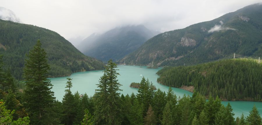
 Ross Lake overlook looking west |
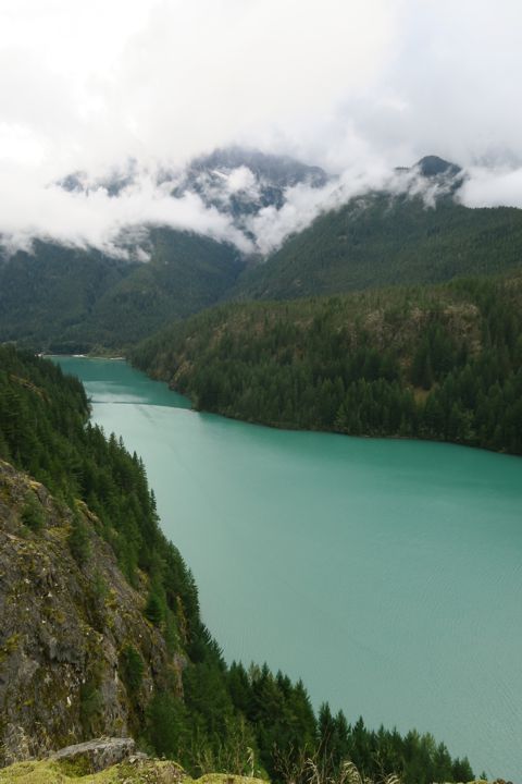
 The Southeast Arm of Ross Lake |
Ross Lake is a hydroelectricity catchment that helps power Seattle, although it also serves to tame the Skagit River, which is famous for flooding. It succeeded in chasing the whole town of Sedro-Woolley a mile up the bank back at the end of the 19th Century. The milky color of the lake is due to it being partly fed by glacier melt, called "glacier milk." Highway 20 is a masterpiece of mountain taming, and a proud project of WADOT (the Washington Department of Transportation.) Check out their Flickr celebration of the clearance and reopening of the highway here. The Cascades themselves were playing coy with us today. We never really saw the heights, as they were wreathed in cloud, and could only be inferred. |
|
The clouds were doing their thing by the time we reached the second of three passes, Rainy Pass, where it was indeed rainy. Ahead we saw the lower slopes of the next range of mountains. By this time the Nav Lady had recognized the highway and was reassuring us about the timely completion of the day's ride. I had, however, forgotten to turn off the EV-only and we had consumed the power I had been meaning to preserve. However, the regenerative braking and the serious downslopes ahead had restored more than 7 miles (about 25%) of our EV range by the time we rolled out of the last downslope on the east side of the range. |
 |
 |
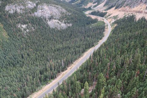
We took the side road to the Washington Pass Overlook, a magnificent spot atop a bold outcropping of granite. Rochelle was impressed with the trail and railings at the overlook; someone(s) put a lot of thought and pride into this spot. At left is the highway as it winds its way down eastward from the 5,477 foot Washington Pass. |
|
You may remember my question along the Drury Scenic Parkway in Redwood National Park: Why do tall trees have twisted trunks? Check out this twisting! If it's due to the rotation of the earth, why is it more extreme here? Are the winds on the north side that much more extreme than the winds on the south side of the tree? These trunks were beside the trail at the Washington Pass Overlook.
Below: the bones of the mountains at the Washington Pass Overlook. |
 |
 |
 |
And then we were home. Here in Mazama, we're at the upper left corner of High Desert, in the rain shadow of the North Cascades in our very comfortable little cottage. Thank you, Phil! |
 |
updated 18 November 2024 Caspar Time site software and photographs by the Caspar Institute except as noted this site generated with 100% recycled electrons! send website feedback to the CI webster © copyright 2002-2024 Caspar Institute |