
Cassis
We left Dali's Two-torched Liberty behind as we bussed back to the Figueras side of the mountain and resumed our train trip France-ward.
 | ||
Cassis
We left Dali's Two-torched Liberty behind as we bussed back to the Figueras side of the mountain and resumed our train trip France-ward.
| ||
 northeastern Spain |
The rocky Spanish countryside pushed us right out to the brink of the sea at Cérbére, where we passed through an apparatus that magically turned our polite Spanish train ("Bing-bong-ding; Señores viajeros...") into a rude French one (no announcements of upcoming stations whatsoever. After all, if you don't know, you don't belong!)
|
After a five hour train trip punctuated only briefly by a quick and lucky transfer at Montpellier to a train we should have missed by three minutes, we arrived at Marseilles Saint Charles, what may be the world's least friendly and most chaotic railroad station.
Within a very few minutes of arriving, while I was working my way through the unpardonably long and slow-moving ticket line and getting our outbound reservations for Thursday in order, Sienna and Rochelle, who were guarding our substantial pile of luggage – four large bags, four smaller packs, two miscellaneous bags – were repeatedly cased by a fat, shady character in sweats who ran when he saw the police, then snuck back to scheme on them again.
Later, while I was determining that a taxi was our best, even if most expensive, means of getting out of Hell and away to Cassis, my three compatriots were cased again by another set of sleazebags while watching several spectacular demonstrations of bad French parenting, including cap guns and mock sibling assassination, ear-tweaking, gratuitous whacking, and parental yelling.
I think the station must be one of those negative focal points in the world, like Bayonne, New Jersey and Winnemucca, Nevada, where everyone is in a perpetually bad mood... And yet the ticket agent that helped me was cheery and chirpy; I love the way the French can make the littlest "thank you!" into a song.
We found our taxi, but were unable to get in and leave because there was a bomb-warning being investigated. "Where might the bomb be?" we asked, and our taxista shrugged and said "Perhaps in the parking area below us, or the lockers..." Well, that seems like a good enough reason to keep everyone in the station to me!
|
Over the hill in Cassis fifteen minutes later was like a sunny day following a stormy night. Although the streets were overwhelmed with Sunday day-trippers, it felt safe again, and civilized (as long as one spoke French.) As the sun subsided behind the clouds – it had been threatening all day – the town emptied, and we were able to find a quiet, superb little restaurant on a back street for a delicious dinner.
|
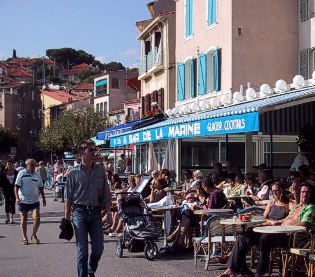 Cassis afternoon |
We enjoyed our first day in Cassis by doing as little as possible – shopping for lunch, finding the internet café, doing laundry, sitting in the café, writing, and sipping coffee and tea. It was a healing thing to do, one of the first truly unburdened days on this trip (or so it seemed. Actually, we had a days like that in Cadaqués, Nerja, Marbella, and Salema.)
On our second day, a little restless and knowing that there was a world-class walk at our doorstep, we again sought the ingredients for a picnic lunch – we knew better where to get veggies, and so it was a better feed – and then headed up the trail off the far end of the port toward the calanques.
The whole headlands east of Marseille is a series of limestone upthrusts and declivities. Cassis sits in a U-shaped crescent and has a good beach and port, but behind it and on both sides, limestone headlands thrust up suddenly to considerable height. Between Marseille and Cassis, the headland is more fractured, and several – eight, apparently – of the faults have been converted through the ages into the French equivalent of fjords, steep sided, deep, narrow inlets cutting deep into the headland, and in several cases ending in small, picturesque beaches. These calanques are formed, we are told, by underground upwellings of fresh water originating in the hills behind, running through the fractured limestone, dissolving it until a calanque is formed. The rising level of the Mediterranean (or the subsidence of the land mass) has filled the calanques with seawater.
|
 Port Miou spar forest |
One can take a boat ride to the calanques, 150 francs ($21) to see all eight, 100 francs ($14) to see the first three. Or one can walk. The trail starts easy, along the road to Port Miou, the first calanque, which happens to be completely taken up with the yachts of the Cassis Yacht Club. Since the whole area is supposedly a protected natural area, one doesn't have to think very hard to conclude that protection is an idea conditioned by wealth. |
And a disgusting little demonstration of have-and-have-not it is, too: hundreds of unused, pricey floating baubles line both sides of what might be a glorious geological feature and playground. One can still see the upwelling freshwater at the head of Port Miou with such volume that the water there is clear and brackish. Just a hundred meters farther along, the water is clouded with ...oh no! Could it be? Isn't it comforting to know that rich peoples' shit isn't as polluting as poor peoples'? |
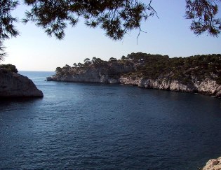 the first calanque beyond the yacht outrage |
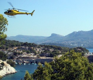 looking back southeast toward Cassis |
The ocean end of Port Miou shows just how lovely this calanque might be. Above it, the trail crosses a vein of limestone of such hardness and whiteness that it's easy to see why it was prized until the quarries were closed (to protect the calanques) in the 1930s. Port Miou limestone was used for the base of the Statue of Liberty. Now it provides an exceedingly slippery series of ledges that the trail climbs. In places, authorities have cut grooves in the steps to make them less slippery, but the footing is treacherous when dry and must be impossible when wet. |
As we walked up the trail, we passed a woman with her leg in an inflatable splint being cared for by three large Frenchmen in red jumpsuits; moments later, a yellow helicopter arrived to medivac her out – a dramatic (and color coordinated) way to conclude one's visit to the calanques, we supposed, but we all redoubled our care as we climbed.
Fortunately, the fine-grained limestone stops at the ridge-top, and the far side, down into Port Pin, is merely broken rock and treacherous talus. Scarcely two miles from central Cassis, this calanque parallels Port Miou, and is shorter (but blessedly uncluttered by yachts – relatively: there were three riding at anchor.) Lots of people make it to Port Pin, and loll about on the slabs of limestone. A few hardy souls even get in the water ... later, Chad and Sienna joined them, but it wasn't quite warm enough for me to jump in. |
 Chad gallantly helps Rochelle |
 the second calanque: Port Pin |
From Port Pin the trail splits, and either climbs up the dry creek bed or assaults the next ridge directly. The trail marking was ambivalent, and so we scrambled directly up the ridge and then made our way across the scrubby top in the general direction we thought might lead us to the next calanque, the one we wanted to see, En Vau. On top of the ridge there were few trees, the sunlight was harsh, and tempers were short. |
Finally, we found the brink of En Vau, and immediately concluded that we were unlikely to reach the beach at its head, even though we couldn't see it yet. We scrambled along the edge (some of us grumbling) until finally the little beach revealed itself to us, easily 400 meters straight down an unscalable cliff. Well, unscalable for us, but rock climbers come from all over the world to try the cliffs above En Vau – we saw some of them as we hiked along, yodelling to each other from the dizzy heights. |
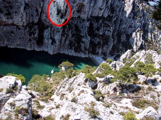 third calanque: En Vau -- beach at right
note rock climbers (white specks in red oval) |
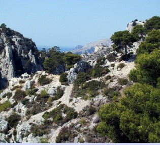 as close as we got to calanques 4 - 8 |
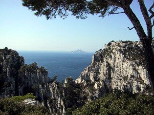 vertical countryside beyond En Vau |
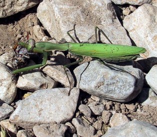 native found along the path |
A little further on we found what looked like the trail down to the head of En Vau, but by then we were hot and tired and happy to settle for the trail to Port Pin, lunch, and perhaps a swim, there.
Back down to Port Pin and the delicious picnic I'd schlepped all this way. Chad left us before he finished lunch – more tomatoes and plums for us! – and hurried back into town, taking a high road to avoid the slippery part. |
We lounged at Port Pin, enjoyed the car-free calm and the company of other hikers (including one poor French fellow who was mercilessly ribbed by his fellows when his cell phone rang), then made our way slowly and carefully back over the ridge, down the slippery section, and along the yacht harbor ...er, the calanque of Port Miou.
Part way along the harbor, the old buildings of the quarry still stand, and are the focal point of a protest against plans being put forward for the expansion and further gentrification of the yacht harbor. Not content to have merely filled the calanque with shit, the rich French boat owners now want to reopen the quarry, and use the proceeds of its operation to build a palatial and, need it be said, exclusive yacht club.
|
 Port Miou paths: GR98 left, yachties right |
Plans would include a detour through the scrubby uplands for the present national trail, GR98, that presently scrambles along the edge of Port Miou (while the privileged boaties walk along a wooden-and-metal boardwalk that further pollutes and uglifies the calanque.) The old buildings serve as the focal point for a protest against this development, Port-Miou pour Tous (Port Miou for Everyone) that even has a website.
The situation at Port Miou, which is a classified area (meaning there's not supposed to be ANY further development, but what's already there can carry on) echoes the same kind of tension we've seen elsewhere. I'm writing this in Vernazza, within the Parco Nationale del Cinque Terre, supposedly a scheme to protect the qualities that make these picturesque villages such a treasure, but the fact here is that the scheme seems to be a success at relieving visitors of their money, but shows very few positive results in controlling development or protecting the environment. The same pattern of trying to protect treasures by creating districts and mouthing platitudes but not enforcing or reversing ill-advised development can be seen everywhere I've traveled, with the single possible exception of the United States where, up until the present administration, progress was being made to make tourism in Yosemite and Yellowstone, for example, sustainable by actually reducing the number of vehicles, campsites, trails, and commercial activities. It's cheering to find the US actually ahead of the game, but it makes the failure here in Liguria, and in Provence, more blatant and aggravating.
|
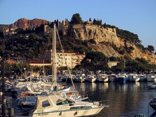 Cassis harbor and castle |
Despite our dark thoughts, we made it back whole to Cassis, where we enjoyed beers and citrons pressés while looking out at the motor-boat choked harbor and the privately owned castle that lords it over Cassis. Not a bad place to be, if you're members of the cultured and moneyed upper classes comme nous... |
Compared to other Europeans, the French may be overweening in their linguistic and social pretensions, but we enjoyed our relaxing, comfortable stay in Cassis quite a lot, and carried on with our next, strenuous travels refreshed. |
 Cassis Castle catching the last rays of the day |
|
|
updated 23 October 2001 : 8:39 Caspar (Pacific) time this site generated with 100% recycled electrons! send website feedback to the Solarnet webster |
© 2001-2002 by Caspar Institute. All Rights Reserved. | |