| itinerary < 18 August Northeastern Oregon 21 August Sylvan Lake, Black Hills > | Across Idaho 19 August 2014 |
|
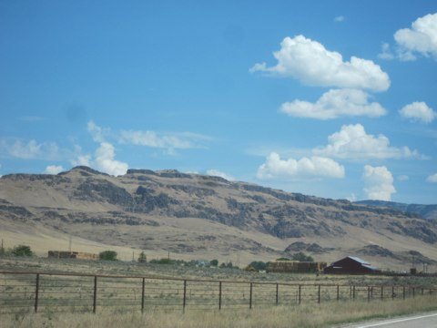
We began the day back on I-84, a magnificent stretch of highway ...if you like that sort of thing. At least it's not truck-choked I-5. East of Baker City, it punches its way through the foothills of the Wallowas, the mountains that give Snake River's Hell's Canyon its name and reputation. The bottomland where the highway likes to run is ranch country, surrounded by imposing lava-tapped mesas and buttes. Just over the border into Idaho we enter the Snake River valley that stretches its way across Idaho's broad bottom. Watered by the mighty Snake that rises near the Tetons -- see Wednesday -- this magnificent agricultual valley produces most of our potatoes. |
 |
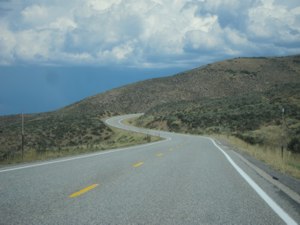 Highway 20 running up the foothills of the Sawtooths |
South of Boise, US 20 cuts into the foothills of the ranges that comprise Idaho's impenetrable center. For me, the trip begins here. Up until now, except for our familiar passage up US 101 along the west coast, we have been racing along on one of the most effective anti-local devices invented by man: the freeway. Except for a periodic rash of franchised operations, interstate highways eliminate the character of the countryside. Here, with the twisty two-lane road, we are finally into the heart of the land. Through such towns as Corral, Picabo, and Carey, we wind along rich green bottoms filled with alfalfa, for much of the way along Camas Creek. Past Carey, the south side of the highway is dominated by lava fields, presaging our first destination: Craters of the Moon National Monument. |
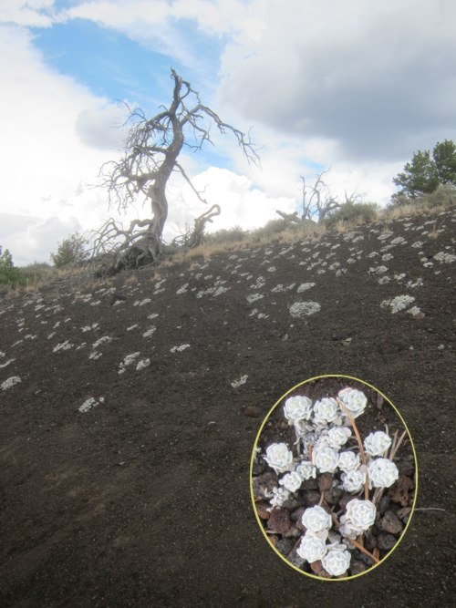
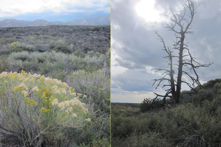
Craters of the MoonThs is what I remember from my previous visit to the Monument: the amazing way the Dwarf Buckwheat (Eriogonum ovalifolium) has adapted to the hostile conditions. In summer, the black cinders easily reach 150 degrees, and rain is a distant memory. In winter, the land is covered with dry snow. The wind always blows. The root system of the Buckwheat is nearly ten times as extensive as the visible plant, and sufficiently sensitive that it spaces itself regularly, so each plant gets enough water to survive. Even when I was eight, I was intrigued by this, and thought there might be some kind of lesson there. As you can see from the inset, this almost sedum like plant is white and hairy, as are many xerophytes -- this reflects sunlight and reduces evapo-transpiration. This is tough habitat. The Limber Pines (Pinus flexilus) doesn't resist the wind, but bends into tortuous shapes because of seasonal changes in the wind direction. Other hardy plants sparsely populate the nearly nutrient-free cinders that make up most of the ground. To the north, the Sawtooths (home of Sun Valley, the famous ski destination) were brewing up the usual afternoon storm, but only a few drops reached us. The clouds provided a spectacular backdrop and shaded us, for which we grateful. Later in the afternoon, we traveled through several squalls generously punctuated by lightning. |
 |

|
 The scale is very large -- inside the little circle are two people climbing the cinder cone |
The geography here, and indeed of the whole broad Snake River valley between Idaho Falls and Hell's Canyon -- Idaho's aforementioned broad bottom -- is the result of the slow passage of the North American Plate over a "hot spot" that presently energizes Yellowstone -- see you there tomorrow! To the far west, up against the Oregon border, the caldera is 16 million years old. The shift of the plate past the hot spot is about two inches per year, or about the speed our fingernails grow. While above the spot, whatever mountains, rocks, and what-have-you are melted from below and replaced by a thin frosting of lava. The lava is especially rich here in this four million year old caldera that comprises Craters of the Moon. |
 |
|
 |
 |
updated 18 November 2024 Caspar Time site software and photographs by the Caspar Institute except as noted this site generated with 100% recycled electrons! send website feedback to the CI webster © copyright 2002-2024 Caspar Institute |